
Quick summary
This guide details the Laugavegur trail from Landmannalaugar to Thorsmork, an iconic journey through Iceland's diverse landscapes of fire and ice. It outlines each stage with distances, elevation, duration, and key features like geothermal areas, lav
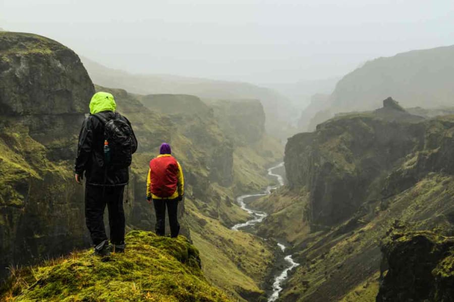
The trek from Landmannalaugar to Thorsmork, known as the Laugavegur trail, is a journey through some of Iceland's most stunning and diverse landscapes. This guide provides comprehensive information for adventurers looking to embark on this iconic trek.

The Laugavegur Trail: A Journey Through Fire and Ice
Landmannalaugar to Hrafntinnusker
This stage starts with an ascent through the Laugahraun lava field near the Landmannalaugar campsite. The trail then winds around Brennisteinsalda, known for its pink flanks and striking contrasts. You'll pass through the geothermal area of Storihver, characterized by hot springs and fumaroles, before crossing an obsidian field to reach Hrafntinnusker. This area is often foggy, so trail markers are essential for navigation.
Distance: 12 km
Elevation Gain: 470 m
Duration: 4-5 hours

Hrafntinnusker to Álftavatn
Many consider this the most beautiful part of the trek. The trail crosses a sandy and snowy plateau with several snow bridges. The contrasting red and black rocks add to the scenic beauty. A highlight is the viewpoint overlooking the lush valley of Lake Álftavatn. To reach the lake, hikers must cross a wide ford.
Distance: 12 km
Elevation Loss: 490 m
Duration: 4-5 hours

Álftavatn to Emstrur (Botnar)
This stage involves crossing two fords before reaching the Hvangil farm. The trail then leads through the Hvannagilshraun lava field and another ford, followed by a vast sandy plain. The path takes you to the Innri-Emstruá river and its waterfall, before entering the Mælifellsandur plain and finally reaching Emstrur.
Distance: 15 km
Elevation Loss: 40 m
Duration: 6-7 hours

Emstrur (Botnar) to Þórsmörk
After crossing the Fremri-Emstruá River, the trail follows the Markarfljót river through lush valleys leading to a significant ford. The path then cuts through a rare birch forest in Iceland, arriving in the glacial valley of Þórsmörk.
Distance: 15 km
Elevation Loss: 300 m
Duration: 6-7 hours

Þórsmörk to Fimmvorduhàls
This stage takes you through the Fimmvorduhàls pass, nestled between the Eyjafjallajökull and Mýrdalsjökull glaciers. The area, affected by the 2010 eruption, offers a dramatic landscape. The trek involves a significant elevation gain and provides views of the "land of the gods."
Distance: 12 km
Elevation Gain: 800 m
Duration: 6-7 hours
Fimmvorduhàls to Skogar
The final stage is a descent to Skogar, marked by a decrease in elevation. This part of the trek offers a relief after the challenging ascent and culminates at the famous Skogafoss waterfall.
Distance: 14 km
Elevation Loss: 920 m
Duration: 6-7 hours

Best Time to Hike
The best time to hike the Laugavegur trail is from late June to early September. During this period, the weather is more stable, and the days are longer.
Safety and Preparation
Weather in Iceland can be unpredictable. Hikers should be prepared for sudden changes in weather conditions.
It's essential to carry a map, compass, and GPS device.
Hikers should inform someone of their plans and expected return.
People Also Ask
How long does it take to hike Þórsmörk?
The hike from Landmannalaugar to Thorsmork typically takes 4-5 days, depending on the pace and experience of the hiker.
How difficult is the Laugavegur trail?
The Laugavegur trail is considered moderately difficult. It requires good physical fitness and some hiking experience, especially due to the changing weather conditions and varied terrain.
Can you hike the Laugavegur trail without a guide?
Yes, it is possible to hike the Laugavegur trail without a guide, even though many choose a Laugavegur Trail Tour with mountain guides for their knowledge of the area. The trail is well-marked, and many experienced hikers choose to do it independently. However, less experienced hikers may benefit from the knowledge and safety a guide provides.

When should I go to Landmannalaugar?
The best time to visit Landmannalaugar for hiking is during the summer months, from late June to early September. During this time, the weather is more favorable, and the days are longer, providing better conditions for hiking.
The hike from Landmannalaugar to Thorsmork is an unforgettable experience, offering a glimpse into Iceland's extraordinary natural beauty. With the right preparation and respect for the trail's challenges, hikers can enjoy a journey through some of the most spectacular landscapes on Earth.


